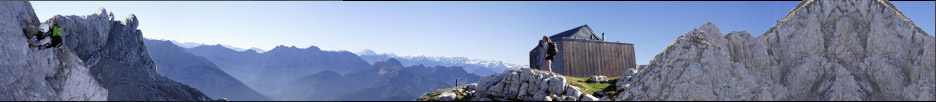
Hüttenliste
Bergliste
Trackliste
Berge
Hilfsmittel
Über Uns
Hilfe
Suche
Harry's Bergliste
Registrieren
DAV Garching

Ed Lane Peak

Nordamerika » USA » Kalifornien » Sierra Nevada » Whitney
Sierra Nevada (USA)


GPS-Tracks


  Folgende GPS-Tracks tangieren diesen Punkt (hier einen Track beginnen):
Name Infos Länge Höhenm. Typ
Es konnten keine GPS-Tracks gefunden werden.


Benachbarte Hütten


  Im Umkreis von 20km, alle Entfernungen Luftlinie / real, alle Hütten.
Name Infos Entf. Richt. Optionen
Es konnten keine Hütten gefunden werden.

Orte in der Nähe


  Im Umkreis von maximal 20 km, alle Entfernungen Luftlinie / real, alle Orte.
Name PLZ Entf. Richt. Optionen
Fish Springs USA-? 16.3km O Karte
Big Pine USA-? 17.5km NO Karte
Aberdeen USA-? 18.7km OSO Karte
Elna (historical) USA-? 19.2km O Karte
Monola USA-? 19.5km ONO Karte
Achtung: Die Lage der Städte und damit auch die Entfernung ist teils recht ungenau und sollte nur als grober Anhaltspunkt angesehen werden. Zudem sind die Angaben lediglich als bewohnte Orte zu verstehen.


Gipfel im Umkreis (Auswahl)


  Im Umkreis von maximal 20km, alle Entfernungen Luftlinie / real, alle Gipfel.
Name Infos Höhe Entf. Richt. Optionen
The Thumb 4071m 1.5km NW Karte
Birch Mountain 4146m 1.6km O Karte
Mount Bolton Brown 4112m 1.7km SSW Karte
Mount Prater 4106m 2.7km S Karte
Balcony Peak 4230m 2.8km WNW Karte
Disappointment Peak 4242m 3km WNW Karte
Middle Palisade 4271m 3.1km WNW Karte
Norman Clyde Peak 4243m 3.6km WNW Karte
Norman Clyde Peak 4223m 3.7km WNW Karte
Mount Williams 4152m 4.2km WNW Karte
Mount Tinemaha 3816m 4.5km SO Karte
Kid Mountain 3615m 4.5km N Karte
Split Mountain 4285m 4.6km SSO Karte
Palisade Crest 4131m 5.3km WNW Karte
Split S1 4190m 5.3km S Karte
Mount Jepson 4081m 6.1km WNW Karte
Mount Sill 4314m 7km WNW Karte
Cardinal Mountain 4083m 7.1km SSO Karte
Temple Crag 3962m 7.4km NW Karte
Mount Gayley 4118m 7.4km WNW Karte
Mount Alice 3541m 7.5km NNW Karte
Polemonium Peak 4292m 7.6km WNW Karte
Vennacher Needle 3961m 7.7km SW Karte
Starlight Peak 4328m 7.9km WNW Karte
Thunderbolt Peak 4268m 8.3km WNW Karte
North Palisade 4341m 8.5km WNW Karte
Dumbbell Peak 3926m 8.6km SW Karte
Observation Peak 3768m 8.9km WSW Karte
Saddlehorn 3722m 8.9km SSW Karte
Mount Shakspere 3711m 9km W Karte
Mount Winchell 4196m 9.2km WNW Karte
Mount Robinson 3952m 9.6km WNW Karte
Mount Ruskin 3938m 9.7km SSW Karte
Columnbine Peak 3859m 9.9km WNW Karte
Mount Agassiz 4234m 10.1km WNW Karte
Isosceles Peak 3755m 10.3km WNW Karte
Columbine Peak 3856m 10.5km WNW Karte
Aperture Peak 4043m 10.6km WNW Karte
Two Eagle Peak 3952m 10.7km NW Karte
Sky Haven 3931m 10.8km NNW Karte
Goodale Mountain 3898m 10.8km SSO Karte
Striped Mountain 4017m 10.9km SSO Karte
Gendarme Peak 4039m 11.3km WNW Karte
Observation SW3 3657m 11.5km WSW Karte
Giraud Peak 3843m 11.5km WNW Karte
Picture Puzzle 4055m 11.8km WNW Karte
Pinchot N1 4043m 11.9km SSO Karte
Windy Cliff 3399m 12.2km WSW Karte
Cloudripper 4122m 12.3km NW Karte
Chocolate Peak 3561m 12.8km NW Karte
Mount Pinchot 4113m 12.9km SSO Karte
Vagabond Peak 4076m 13km NW Karte
Red Point 3622m 13km SW Karte
Mount Goode 3988m 13.6km WNW Karte
Marion Peak 3877m 13.9km SW Karte
Mount Wynne 4017m 14km SSO Karte
Mount Ickes 3942m 14.2km S Karte
Peak 12,960+ "Trapezoid Peak" 3950m 14.3km WNW Karte
Rambaud Peak 3366m 14.4km W Karte
Hurd Peak 3730m 14.5km WNW Karte
Mount Johnson 3923m 15.3km WNW Karte
Crater Mountain 3924m 15.5km S Karte
Arrow Peak 3950m 15.5km SSW Karte
The Citadel 3578m 15.6km WNW Karte
Mount Perkins 3830m 15.6km SSO Karte
Devils Crags 3737m 16.2km W Karte
Langille Peak 3663m 16.2km WNW Karte
Mount Woodworth 3724m 16.5km W Karte
Mount Gilbert 3995m 16.6km WNW Karte
Wheel Mountain 3894m 17.2km W Karte
Pyramid Peak 3895m 17.3km SSW Karte
State Peak 3847m 17.3km SW Karte
Mount Cedric Wright 3771m 18km SSO Karte
Colosseum Mountain 3795m 18.1km SSO Karte
Mount Thompson 4113m 18.2km WNW Karte
Thompson NE1 4055m 18.3km WNW Karte
Dougherty Peak 3731m 18.4km SW Karte
Mount McDuffie 4048m 18.4km WNW Karte
Point Powell (Peak 13,360'+) 4072m 18.9km WNW Karte
Mount Powell 4080m 19.1km WNW Karte
Window Peak 3684m 19.1km SSW Karte
Black Giant 4063m 19.3km WNW Karte
Powell W1 4073m 19.6km WNW Karte
Cardinal Pinnacle 3170m 19.9km NNW Karte

Download der Koordinaten


Letzte Bearbeitung: Unbekannt
Seitenaufrufe: 424
© 2006-2024 Tourenwelt.info. Alle Rechte vorbehalten. Betrieben in Zusammenarbeit mit dem DAV Garching.
Nicht eingeloggt. Einloggen / Registrieren