


Aiguille du Goûter
Europa
»
Frankreich
»
Haute Savoie
»
Mont Blanc Gruppe
»
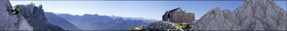
Refuge Goûter
»
Le Nig D'Aigle
»
St.Gervais
»
Bionassay
Alpen » Westalpen » Mont Blanc Gruppe
Alpen » Westalpen » Mont Blanc Gruppe
| Höhe: | 3863m | |||||||||
| Koordinaten: | 45°51'4''N, 6°49'50''O
UTM: X 331569.7, Y 5079803.5, Zonenfeld 32 T |
|||||||||
| Informationen: | Bergbahn St.Gervais - Le Nig d'Aigle | |||||||||
| Karten: |
ASF Petit Saint-Bernard - Mont Blanc (ASF-16) (1:25000) ESC Monte Bianco - Courmayeur (ESC-01) (1:25000) IGC Monte Bianco - Courmayeur - La Thuile - Chamonix (IGC-107) (1:25000) IGC Monte Bianco - Chamonix - Courmayeur - Aosta (IGC-04) (1:50000) SwissTopo 292, Courmayeur (1:50000) SwissTopo 46, Val de Bagnes (1:100000) (Bedingt, Randbereich) |
|||||||||
| Galerie: | Noch keine Bilder verfügbar. |
|||||||||
| Links: |
|
|||||||||
Letzte Bearbeitung:
Donnerstag, 28. August 2008, 22:31 Uhr
Seitenaufrufe: 733
Seitenaufrufe: 733